
LIDAR Analyst
Overview
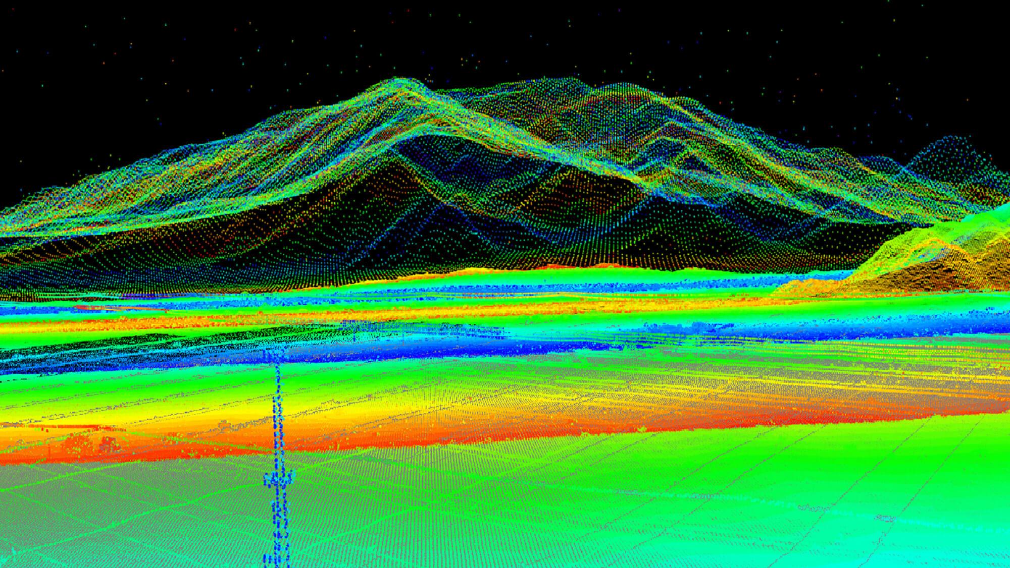
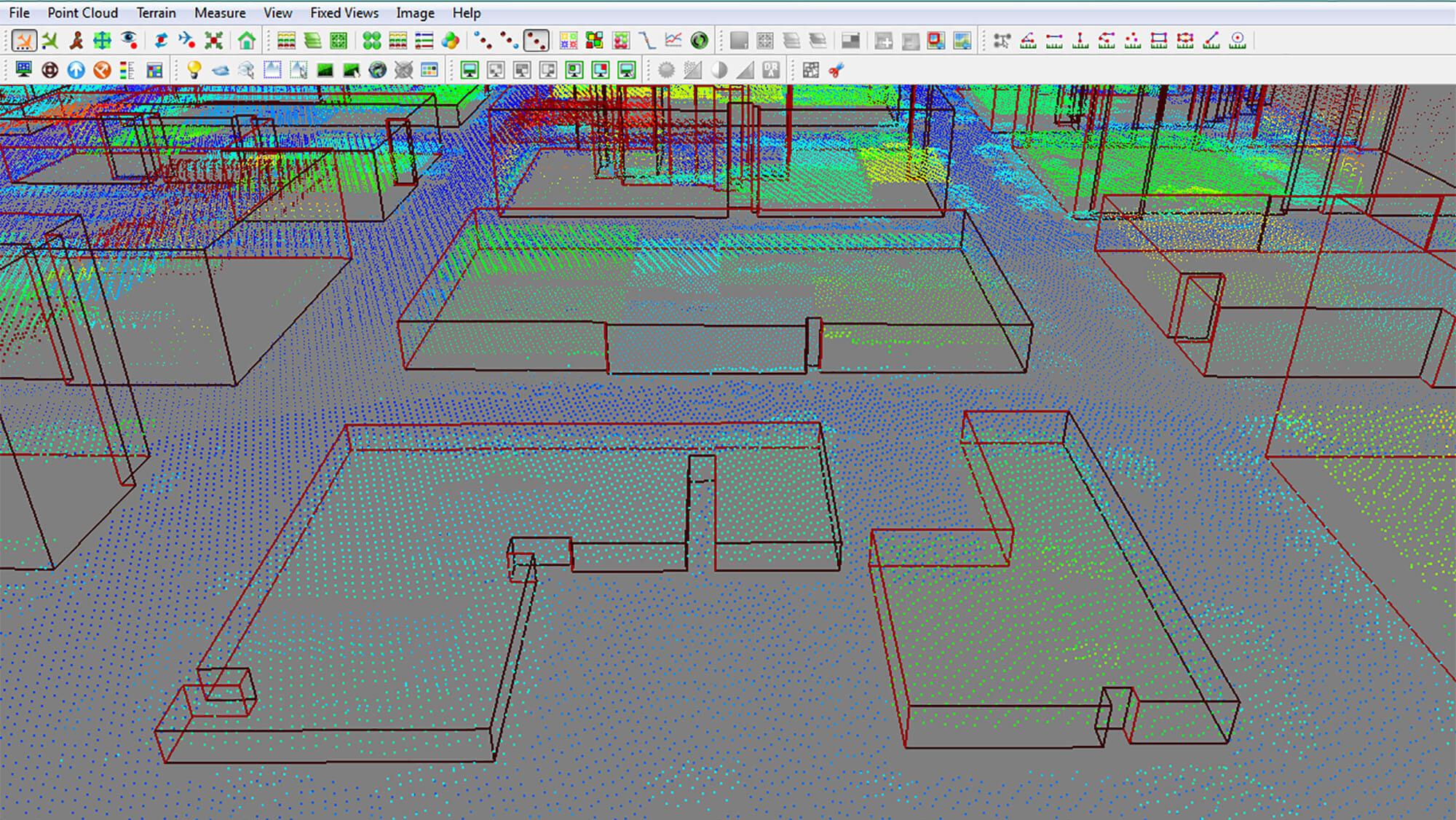
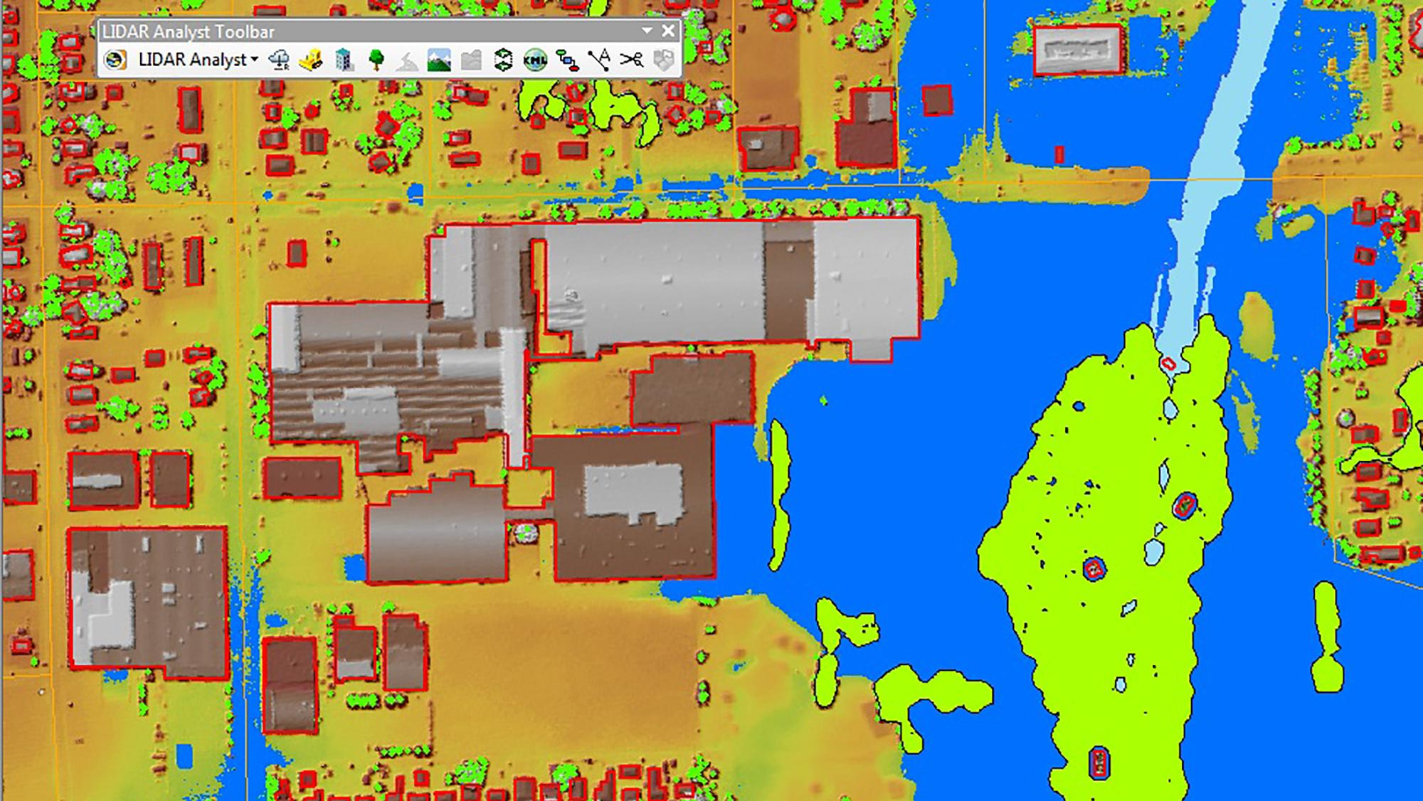
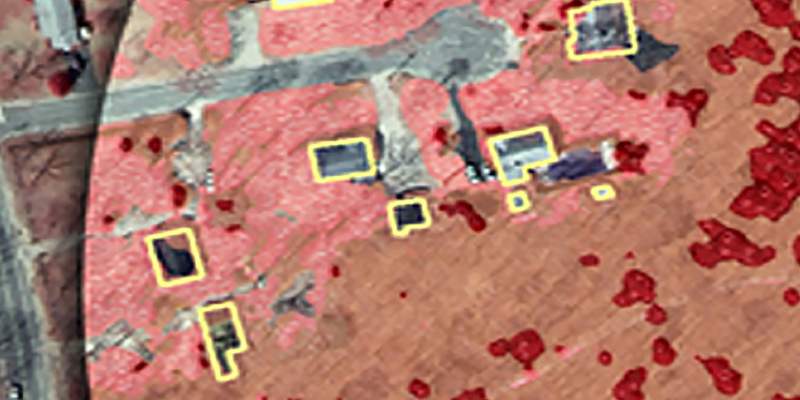
Textron Systems' LIDAR Analyst software is tightly integrated with the Esri® ArcGIS® platform to provide an end-to-end solution for visualizing and processing LIDAR data. Analysts can automatically extract 3D objects such as bare earth, trees or buildings, enabling users to visualize their world for critical decision making.
All products generated from LIDAR Analyst are directly importable into RemoteView™ and can automatically be linked via RVConnect™. LIDAR Analyst can also work in conjunction with Feature Analyst™ to simultaneously extract actionable information from both imagery and LIDAR.
- Import and process LIDAR data from any aerial sensor in a variety of formats
- Extract bare-earth terrain, 3D buildings, tree points or contour lines for depicting elevation
- Quickly generate, modify and analyze a variety of elevation layers for activities such as flood analysis
- Provides visualization of large point clouds and performs real-time editing and analysis
- Create highly accurate and detailed 3D scenes using live data for mission planning and rehearsal
Specifications
| Supported Software | ESRI® ArcGIS Pro® 3.1x - 3.5x |
|---|---|
| Hardware Requirements | Intel® 2.0 GHz or better; 4 GB or better on client |
| Operating Systems | Windows® 10, Windows® 11 |
ArcGIS and Esri are licensed trademarks of Environmental Systems Research Institute, Inc.
Intel is a registered trademark of Intel Corporation in the U.S. and/or other countries.
Windows and .NET Framework are either registered trademarks or trademarks of Microsoft Corporation in the United States and/or other countries
Gallery
Related Content
RemoteView™ PRO
- Image Visualization and Exploitation
- Precise Mensuration and Analysis
Feature Analyst™
- Automated feature extraction
- GIS data creation and finishing tool